| Previous Date | Day By Day Index | 16th OVI Home Page | Next Date |
Where was the regiment from
October 11 to 22, 1863
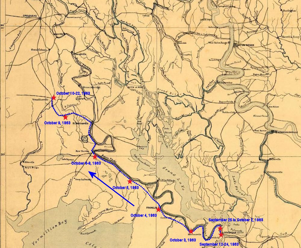
During this time the 16th Ohio camped in the bayou country on or near the Vermilion River. Information is sketchy and a more precise location of the camp cannot be made at this time. It seems the troops were moving north along Bayou Teche toward Opelousas but either deviated west away from Bayou Teche to the Vermilion River or, the two waterways joined together at that time, as shown in the period map, below, or the troops were mistaken as to the name of the river where they camped.
Of this time, Cpl Theodore Wolbach, Company E, mentions:
Forage was plenty and the boys took in large quantities, such as chickens, sweet potatoes, &c.
While in this camp, the Ohio soldiers participated in the Ohio state election. The election for governor of the state was between incumbent Republican governor John Brough and the Democrat nominee Clement Vallandigham. Vallandigham was strongly opposed to Lincoln, the Republicans and was against African-American suffrage and equality. Earlier in 1863, due to the content of his speeches being considered subversive to the Union, he had been arrested, imprisoned and deported to the Confederacy where he was, again, placed under guard. He managed to travel to Canada where, in Windsor, Ontario, he set up his campaign headquarters and received the Democrat nomination for governor. Vallandigham was defeated by a landslide but continued his campaign against equality for blacks until his death in 1871, when he accidentally shot himself in the head. Pvt. Thomas Linn, Company B, provides us with the election results for the 16th Ohio:
| Co. | Brough | Valanding | Total | Co. | Brough | Valanding | Total |
|---|---|---|---|---|---|---|---|
| A. | 7 | 9 | 16 | F. | 12 | 0 | 12 |
| B. | 16 | 4 | 20 | G. | 22 | 0 | 22 |
| C. | 23 | 1 | 24 | H. | 19 | 0 | 19 |
| D. | 18 | 1 | 19 | I. | 17 | 2 | 19 |
| E. | 8 | 6 | 14 | K. | 15 | 0 | 19 |
1863 military map showing the approximate route of the 16th Ohio on its march northwest to a point northeast of Vermilionville (modern day Lafayette), Louisiana, on October 10, 1863.
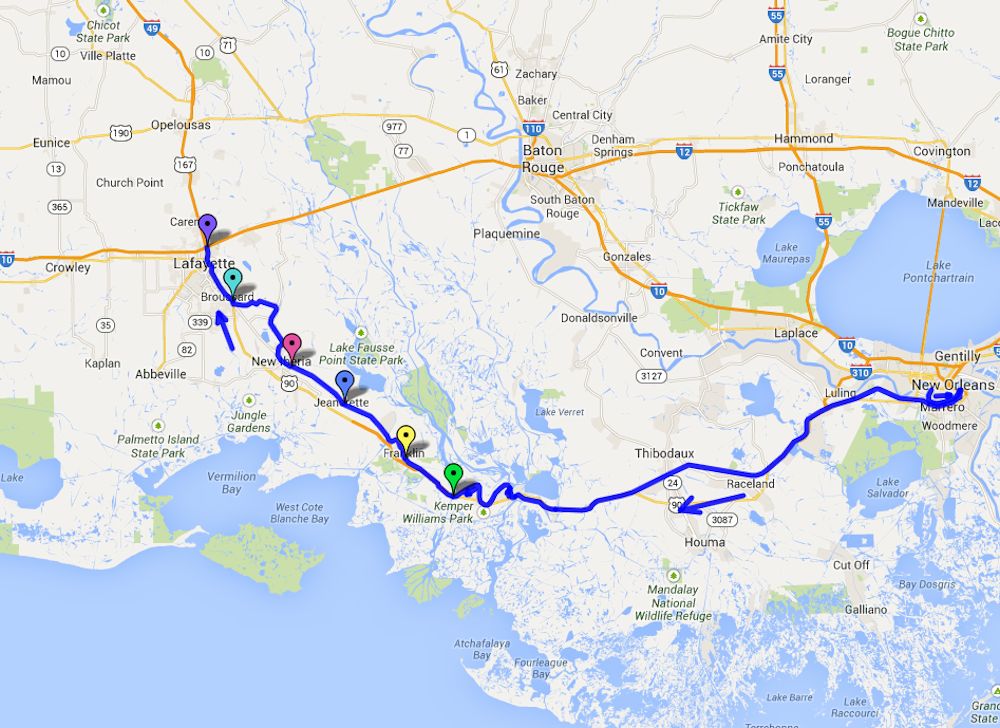
Modern day map showing the approximate route of the 16th Ohio on its march northwest to a point northeast of Vermilionville (modern day Lafayette) on October 10, 1863. This map is zoomed out so the entire route of the 16th Ohio from its start at New Orleans can be seen.
Green pin - Approximate location of the 16th Ohio at or near Fort Bisland, Louisiana, October 3, 1863.
Yellow pin - Approximate location of the 16th Ohio at Franklin, Louisiana, October 4, 1863.
Blue pin - Approximate location of the 16th Ohio, northwest of Franklin, Louisiana, October 5, 1863.
Lavender pin - Approximate location of the 16th Ohio, southeast of New Iberia, Louisiana, October 6-8, 1863.
Aqua pin - Approximate location of the 16th Ohio, October 9, 1863.
Purple pin - Approximate location of the campsite of the 16th Ohio along Bayou Teche near Vermilion Bayou (or River) from October 10 to 23, 1863.
| Previous Date | Day By Day Index | 16th OVI Home Page | Next Date |