| Previous Cumberland Gap Battle Map | Cumberland Gap Index Page | 16th OVI Home Page | Next Cumberland Gap Battle Map |
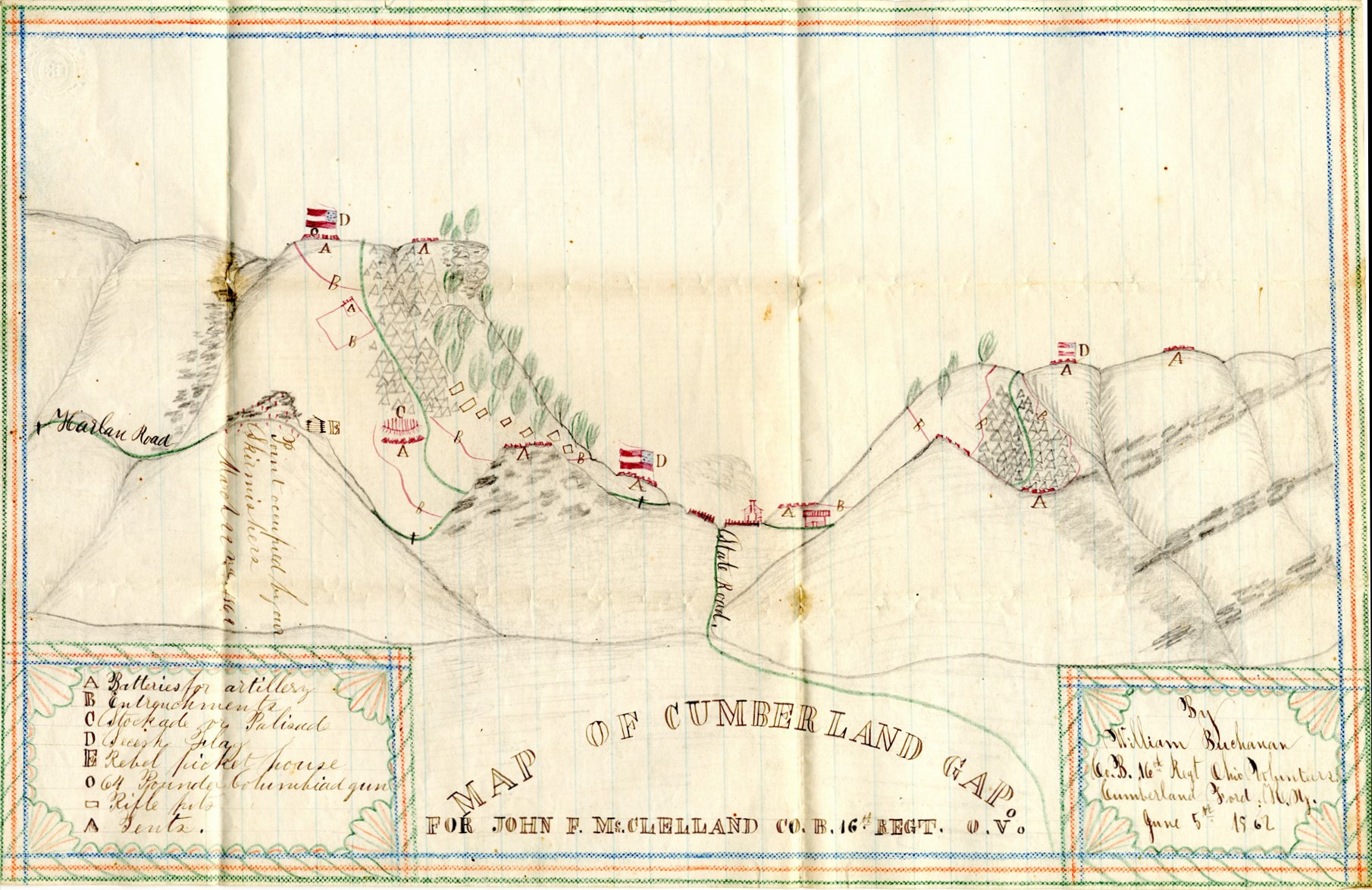
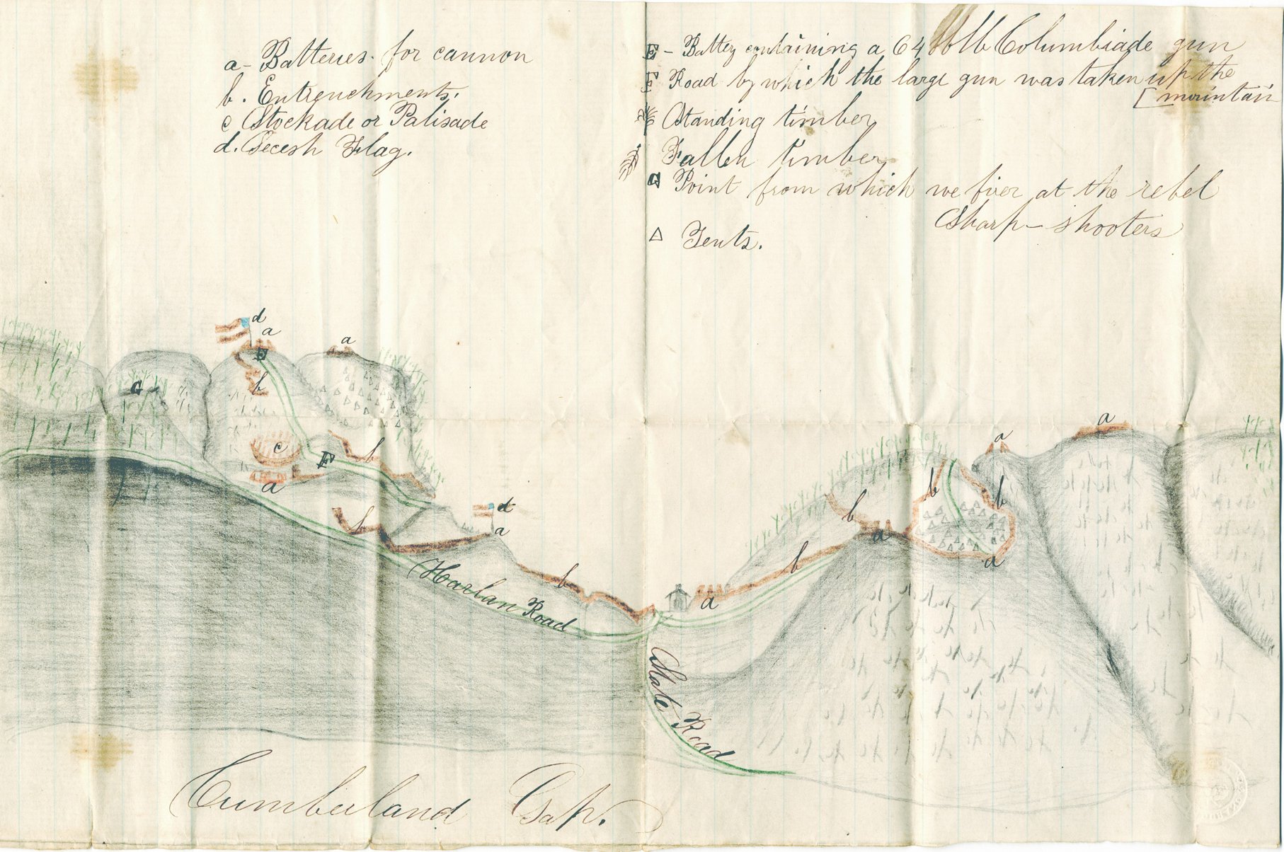
Maps of Cumberland Gap by Sgt. William Buchanan, Co. B
Drawn June 5, 1862
The maps, below, were drawn by Sgt. William Buchanan for Pvt. John F. McClelland. They were made just before the Union occupation of Cumberland Gap.
The recipient of these maps, Pvt. John F. McClelland, became ill to the extent he was left behind when Union forces evacuated Cumberland Gap on September 17, 1862. He soon died of disease on September 20, 1862, in Confederate captivity. See letter from Pvt. John McClelland to his wife, Rachel Lockhart in Millersburg, Ohio, dated June, 1862. The maps, below, are believed to have been sent home in this letter. The view of The Gap is looking southeast. At this time, the the 16th Ohio was camped at the Moss House just south of Cumberland Ford (now Pineville, Kentucky). Although Cumberland Gap, 12 miles distant to the south, was visible, it is assumed the more detailed map, below, was obtained from a point closer to the Gap while on a reconnaissance patrol.
Images of maps and information on John McClelland graciously shared by Bob and Judi Hill.
| Previous Cumberland Gap Battle Map | Cumberland Gap Index Page | 16th OVI Home Page | Next Cumberland Gap Battle Map |