| Prev Chickasaw Bayou Battle Map | Chickasaw Bayou Index Page | 16th OVI Home Page | Next Chickasaw Bayou Battle Map |
Map #9 of Battle of Chickasaw Bayou
December 27 - 29, 1862
December 27 - 29, 1862
Web Author's Notes:
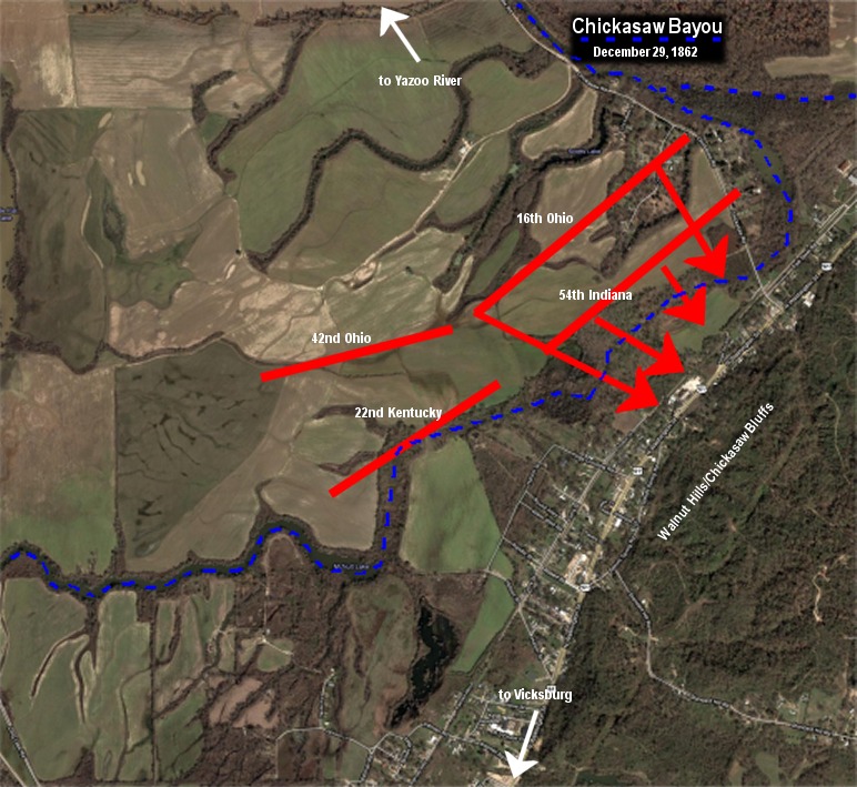
Here is a more detailed aerial view of the battleground as it looks today. I have outlined the current route of Chickasaw Bayou in blue and shown the final positions of the four regiments under Col. John DeCourcey in red (I have not shown the locations of the many other units on the field that day). The 16th Ohio and 54th Indiana attempted to cross the bayou, some being successful, but were met with massive rifle and canon fire from the Rebels entrenched at the base and throughout the bluffs. It is in the area of the red arrowheads where so many of the 16th OVI were killed, wounded and taken prisoner. The web author's great-great grandfather, Captain Milton Mills, Company D, was taken prisoner in this location.
Here is a more detailed aerial view of the battleground as it looks today. I have outlined the current route of Chickasaw Bayou in blue and shown the final positions of the four regiments under Col. John DeCourcey in red (I have not shown the locations of the many other units on the field that day). The 16th Ohio and 54th Indiana attempted to cross the bayou, some being successful, but were met with massive rifle and canon fire from the Rebels entrenched at the base and throughout the bluffs. It is in the area of the red arrowheads where so many of the 16th OVI were killed, wounded and taken prisoner. The web author's great-great grandfather, Captain Milton Mills, Company D, was taken prisoner in this location.
The following map created from Google Maps and editing using JASC Paint Shop Pro 7.04.
| Previous Battle Map | Chickasaw Bayou Index Page | 16th OVI Home Page | Next Chickasaw Bayou Battle Map |