| Prev Chickasaw Bayou Battle Map | Chickasaw Bayou Index Page | 16th OVI Home Page | Next Chickasaw Bayou Battle Map |
Map #8 of Battle of Chickasaw Bayou
December 27 - 29, 1862
December 27 - 29, 1862
Web Author's Notes:
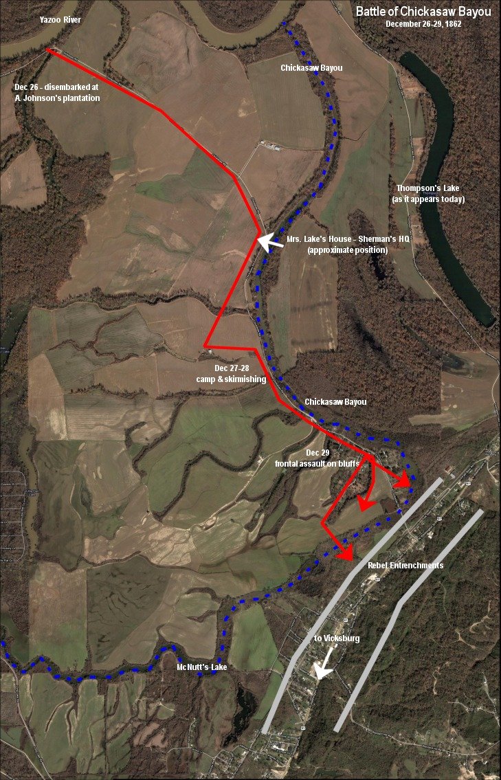
Here is an aerial view of the battleground as it looks today. The route of Chickasaw Bayou is outlined in blueand shows the route taken by the 16th and DeCourcey's brigade in red from Dec. 26 thru the morning of the 29th (the location of the many other units on the field is not shown). There was light skirmishing on the 26th and 27th with heavier fighting on the 28th, culminating in the main battle on the 29th. See the next map for a little more detail on the 16th's position on the 29th.
Here is an aerial view of the battleground as it looks today. The route of Chickasaw Bayou is outlined in blueand shows the route taken by the 16th and DeCourcey's brigade in red from Dec. 26 thru the morning of the 29th (the location of the many other units on the field is not shown). There was light skirmishing on the 26th and 27th with heavier fighting on the 28th, culminating in the main battle on the 29th. See the next map for a little more detail on the 16th's position on the 29th.
The following map created from Google Maps and editing using JASC Paint Shop Pro 7.04.

| Previous Battle Map | Chickasaw Bayou Index Page | 16th OVI Home Page | Next Chickasaw Bayou Battle Map |