| Previous Arkansas Post Battle Map | Arkansas Post Index Page | 16th OVI Home Page | Next Arkansas Post Battle Map |
January 9-11, 1863
Web Author's Notes:
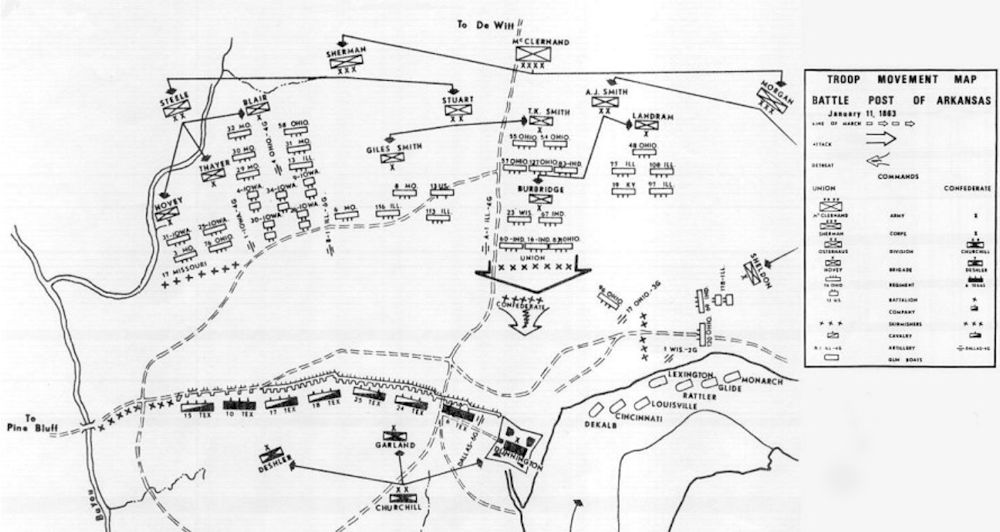
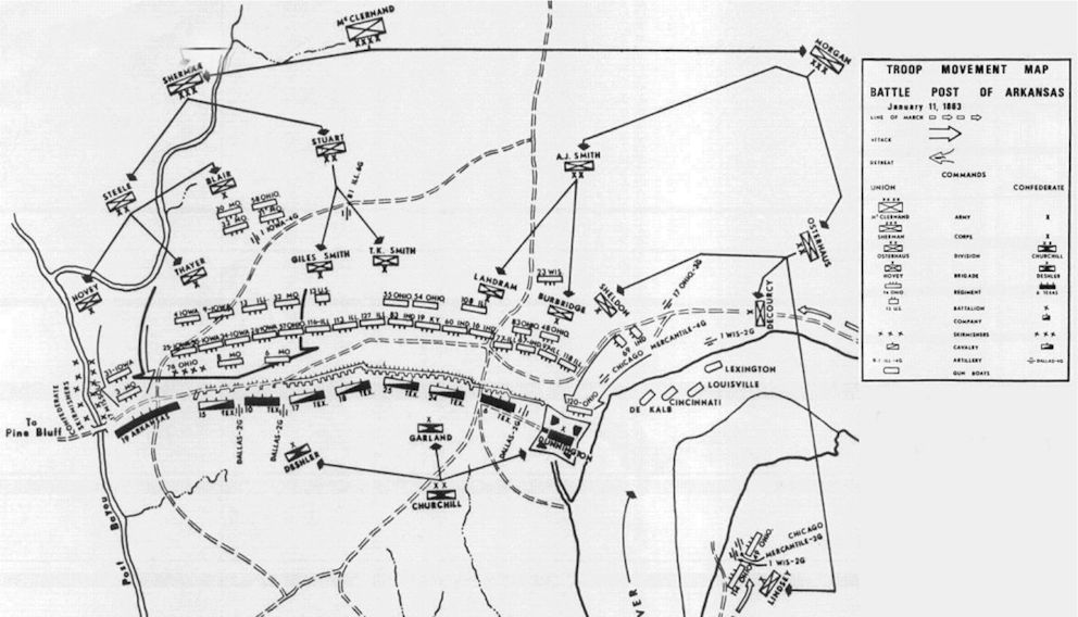
This map is from historian Edwin C. Bearss' Arkansas Post National Memorial - Structural History Post of Arkansas, 1804-1863 and Civil War Troop Movement Maps Janaury, 1863 written in April, 1971 for the United States Department of the Interior, National Park Service. The first map shows the Union positions on the morning of January 11, 1863. The second map shows the progress of the troops about 5:00pm that afternoon.
Note that Col. DeCourcey's brigade does not appear on the first map as they were still held in reserve near the landing site, east of the fort. DeCourcey's bridgade appears on the second map (5:00pm) showing their route after being called up by Gen. Morgan.
early on January 11, 1863:

late afternoon on January 11, 1863:

| Previous Arkansas Post Battle Map | Arkansas Post Index Page | 16th OVI Home Page | Next Arkansas Post Battle Map |