| Previous Red River Campaign Map | Red River Campaign Index Page | 16th OVI Home Page |
Map #3 - The Red River Campaign
March 10 to May 22, 1864
Bailey's Dams
April 30 to May 13, 1864
March 10 to May 22, 1864
Bailey's Dams
April 30 to May 13, 1864
Web Author's Notes:
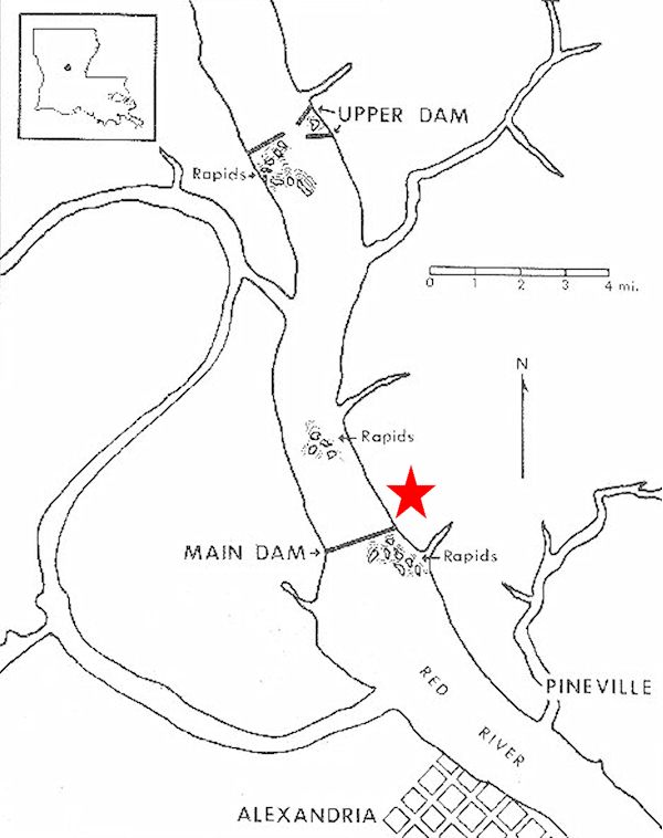
This is a map showing the area of the Red River, near Alexandria, Louisiana, where Col. Joseph Bailey built several dams. The dams were used to raise the water level of the river to the point where a fleet of Federal gunboats, trapped above the "upper falls" (or rapids) could pass to the deeper waters in front of and below Alexandria. The red star indicates the approximate position of the right wing of the 16th Ohio where it was working on building the "tree dam" from the eastern shore of the river.
This is a map showing the area of the Red River, near Alexandria, Louisiana, where Col. Joseph Bailey built several dams. The dams were used to raise the water level of the river to the point where a fleet of Federal gunboats, trapped above the "upper falls" (or rapids) could pass to the deeper waters in front of and below Alexandria. The red star indicates the approximate position of the right wing of the 16th Ohio where it was working on building the "tree dam" from the eastern shore of the river.
| Previous Red River Campaign Map | Red River Campaign Index Page | 16th OVI Home Page |