| Battle of Tazewell Index Page | 16th OVI Home Page | Next Tazewell Battle Map |
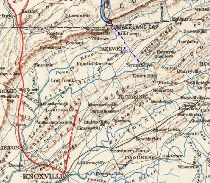
Map of Tazewell, Tennessee Area
Web Author's Notes:
The web author, at this writing, has been unable to find a period map showing the actions and movements of the military forces at the Battle of Tazewell, Tennessee. Presented below is a period map of the area, primitive as it may be, showing the Cumberland Gap, Tazewell and the surrounding area. If anyone has knowledge or access of a better map of this battle, this website would greatly appreciate sharing.
The web author, at this writing, has been unable to find a period map showing the actions and movements of the military forces at the Battle of Tazewell, Tennessee. Presented below is a period map of the area, primitive as it may be, showing the Cumberland Gap, Tazewell and the surrounding area. If anyone has knowledge or access of a better map of this battle, this website would greatly appreciate sharing.
The dashed blue line, below, indicates the approximate route of DeCourcey's brigade with the 16th OVI on August 6, 1861

| Battle of Tazewell Index Page | 16th OVI Home Page | Next Tazewell Battle Map |