| Previous Cumberland Gap Battle Map | Cumberland Gap Index Page | 16th OVI Home Page |
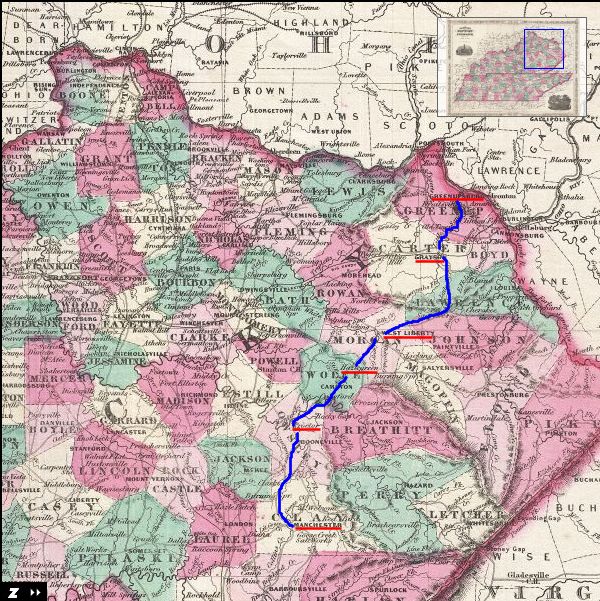
Map of the Morgan's Evacuation Route from Cumberland Gap
September 17 through October 3, 1862
September 17 through October 3, 1862
Web Author's Notes:
This map was created by A. J. Johnson in 1866. I have added a notional route that is close to what Gen. G. W. Morgan's 7th Division, along with the 16th Ohio Volunteers, would have taken as they evacuated Cumberland Gap on September 17, 1862, and proceeded on a torturous route north and east toward the safety of the Ohio River. As more is learned about the details of this march, I will adjust the map accordingly, although the exact route the troops took may never be fully known as the march didn't always follow even the bad roads and some elements of the division took separate but parallel routes. * See second map, below, for a larger view of northeastern Kentucky with same route highlighted.
This map was created by A. J. Johnson in 1866. I have added a notional route that is close to what Gen. G. W. Morgan's 7th Division, along with the 16th Ohio Volunteers, would have taken as they evacuated Cumberland Gap on September 17, 1862, and proceeded on a torturous route north and east toward the safety of the Ohio River. As more is learned about the details of this march, I will adjust the map accordingly, although the exact route the troops took may never be fully known as the march didn't always follow even the bad roads and some elements of the division took separate but parallel routes. * See second map, below, for a larger view of northeastern Kentucky with same route highlighted.
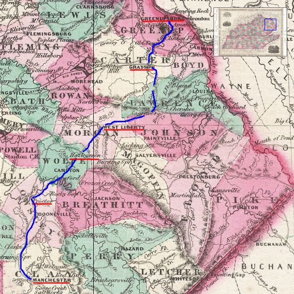
A wider view map of Gen. George W. Morgan's evacuation of Cumberland Gap and Retreat to the Ohio River. Records indicate Morgan's Division marched north from Cumberland Gap to Manchester, Kentucky, then through the towns of Proctor, Hazelgreen, West Liberty and Grayson, finally reaching Greenupsburg, Kentucky, on the Ohio River on October 3, 1862. From there the Division took boats to Wheelersburg.
| Previous Cumberland Gap Battle Map | Cumberland Gap Index Page | 16th OVI Home Page |